|
MARYLAND / DELAWARE MAPS
|
|||||||
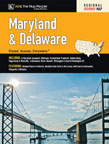
| Maryland Delaware State Map AMC folded 9780841603370 4.95 Navigate the Old Line State and the First State with this up-to-date offering from those meticulous folks at American Map. |
|||||||
| Maryland/Delaware State Road Atlas American Map Company staple bound 84 pages 9780875307992 14.99 Large-scale road maps and street maps of major cities join information on points of interest and recreational facilities to make this something your GPS system can’t match. |
|||||||
| Northern Chesapeake Bay Chart 6th ed GMCO Maps folded 9780875306544 12.95 This waterproof map covers Havre De Grace to Little Choptank River and includes enlargements of Annapolis Harbor and Baltimore Harbor. |
|||||||
| Southern Chesapeake Bay Chart 6th ed GMCO Maps folded 9780875306575 12.95 Now waterproof, this map covers Tangier Island to Cape Henry and includes 1 minute latitude and longitude grid, local names of waterways and fishing areas, artificial reefs and much more. |
|||||||
| Wilmington Delaware Folded Map 3rd ed. ADC folded 0-87530-620-9 3.95 The excellent cartography you've come to expect from ADC presents Winterthur Gardens, Brandywine Creek State Park, indexed streets and much more. |
|||||||
|
|||||||


