|
MARYLAND / DELAWARE MAPS
|
|||||||
| Annapolis Maryland Map Alexandria Drafting Company folded 9780875307060 4.99 This comprehensive map covers downtown, U.S. Naval Academy, Arnold, Cape Saint Claire, Crownsville, Davidsonville, Edgewater and Highland Beach. |
 
|
||||||
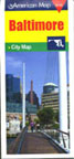
| Baltimore City Map ADC folded 0-84165-467-0 4.95 Here are the cartographic basics of Charm City in folded form. |
|
||||||
| Central Chesapeake Bay Chart 6th ed GMCO Maps folded 9780875306551 12.95 Now waterproof, this map covers Calvert Cliffs to Crisfield, with enlargements of Solomons Island and Crisfield. |
 |
||||||
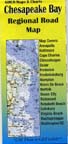
| Chesapeake Bay Regional Road Map GMCO Maps & Charts folded 13401 4.99 Some people explore the Chesapeake by car rather than by boat. This map is for them. |
 |
||||||
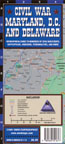
| Civil War Maryland, D.C. and Delaware WNEK Cartographics laminated fold 0-9665516-1-3 6.95 A waterproof geographical guide to hundreds of Civil War events, battlefields, museums, personalities and more. |
 |
||||||
 |
|||||||
|
|||||||