|
BOATING
|
|||
| 30 Kayaking Tours within One Hour of Washington, D.C. Steve Smolinski trade paper 9781581571592 208 pages 18.95 Enjoy the incredible diversity of waterways ideal for outdoor recreation just a short distance from the American capital with this unique book. |
  |
||
| Central Chesapeake Bay Chart GMCO Maps folded 9780875306551 12.95 Now waterproof, this map covers Calvert Cliffs to Crisfield, with enlargements of Solomons Island and Crisfield. |

|
||
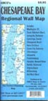
| Chesapeake Bay Regional Wall Map GMCO Maps folded 9780875305875 9.95 Plan your Chesapeake excursion with ports of call such as Dover, Annapolis, Cambridge, Easton, Havre de Grace, Chincoteague, Newport News and many more. |
 |
||
| Chesapeake Bay Waterproof Chart Book 8th ed GMCO Maps & Charts spiral bound 104 pages 9780875305844 59.95 If you can afford the boat and the gas, what’s the problem with a sixty dollar map to keep you from wasting either? Includes enlargements of key ports. |
 |
||
|

|
||
|
 |
||
| Exploring The Chesapeake in Small Boats John Page Williams, Jr. trade paper 0-87033-429-8 190 pages 12.95 Covers water safety, boat selection and seamanship as well as the ecology of the Bay's intricate waterways. |

|
||
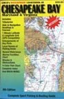
| Guide to Cruising Chesapeake Bay 2009 Chesapeake Bay Magazine spiral bound 392 pages 9781884726149 3.98 This edition includes more than 800 updates, 300 secluded anchorages, a calendar of events and a plethora of information for the cruiser. |
 |
||
| Hiking, Cycling & Canoeing in Maryland: A Family Guide 2nd ed Bryan McKay trade paper 9780801887673 504 pages 21.95 For each of the 23 walks, 16 bicycle rides and 19 canoe trips, the author includes natural history and ecology information as well as maps and detailed directions |
 |
||
|
 |
||
|
 |
||
|
 |
||
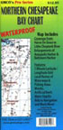
| Northern Chesapeake Bay Chart GMCO Maps folded 9780875306544 12.95 This waterproof map covers Havre De Grace to Little Choptank River and includes enlargements of Annapolis Harbor and Baltimore Harbor. |
|
||
|
 |
||
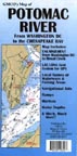
| Potomac River Map GMCO Maps folded 9780875300061 5.95 Here is the river from Washington D.C. to the Chesapeake Bay, with an enlargement from DC to Broad Creek, LAT/LONG grid system for GPS, local names of waterways and fishing areas and more. |
 |
||
|
 |
||
| Sea Kayaking Maryland's Chesapeake Bay 1st ed Savario & Nolan trade paper 224 pages 0-88150-567-6 18.95 The Chesapeake boasts 4,600 miles of tidal shoreline suitable for Kayaking and here are some of the best day trips for paddlers. Includes important information on put-ins and take-outs, winds and currents, equipment, paddling techniques, and safety issues. |

|
||
|
|
||
|
 |
||
|
 FOLDED LAMINATED |
||
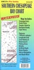
| Southern Chesapeake Bay Chart GMCO Maps folded 9780875306575 12.95 Now waterproof, this map covers Tangier Island to Cape Henry and includes 1 minute latitude and longitude grid, local names of waterways and fishing areas, artificial reefs and much more. |
|
||
 |
|||
 |
|||
